

|
http://goo.gl/maps/BRJd I noticed this the other day looking at random stuff in satellite view. Just south of Dulles airport in NoVA there is a test track of some kind. I'm guessing its used by law enforcement because there seem to be a lot of cop-style cars parked inside the track. I would love to get on there and do a few laps on a motorcycle or sports car.
|
 #
?
Dec 6, 2010 20:46
#
?
Dec 6, 2010 20:46
|
|

|

|
| # ? Apr 27, 2024 17:36 |
|
|
ActionExpress posted:Thats actually on Coronado Island in San Diego, This seems pretty weird unless you actually post the surroundings, where you have two airplanes on their way to bomb the swastika: 
|
|
#
?
Dec 6, 2010 20:58
|
|


|
Schnozzberry posted:http://goo.gl/maps/BRJd Cool. Here's another one in San Fernando, CA. http://maps.google.com/maps?q=34.29...6,0.004823&z=18
|
|
#
?
Dec 6, 2010 21:19
|
|

|
ymgve posted:This seems pretty weird unless you actually post the surroundings, where you have two airplanes on their way to bomb the swastika: If you cross the road (http://goo.gl/maps/jsdn), you can see the are where all Navy SEALs go through part of their training. There used to be a few old helicopter shells southish of the link, but I don't see them anymore. When I lived on Coronado and was stationed at North Island, we never considered this part of Coronado Island, and that the Silver Strand was a totally different area. Jiro Kage fucked around with this message at 22:00 on Dec 6, 2010 |
|
#
?
Dec 6, 2010 21:55
|
|

|
Megadyptes posted:Came here to post something in the exact same area. Hmm.. That line (199 miles) starts east of Novoil'inka 53�33'26.58"N 79�18'7.47"E and ends North east of Ilinka 51�58'9.14"N 82�23'5.45"E Interestingly there is a second line (228miles) running pretty much parallel to that 40-60 miles south west starting just east of Burla 53�20'11.71"N 78�21'58.58"E ending just South West of Varsharva 51�22'41.30"N 81�43'6.62"E Both line several intersect small towns along the way, I initially wondered if it was maybe an old train track route, there is a train track running right next to a good chunk of the southern line, or possibly initial forest clearance lines with towns spread along the route. But it could well be buried utilities and jet fuel pipelines or whathave you, built in good old fashion 3/4 mile wide soviet style.
|
|
#
?
Dec 6, 2010 22:41
|
|

|
Didn't see anyone post this one, but welcome to Centralia, PA. Lots of streets, but almost nothing is left. If you aren't familiar with Centralia and the underground inferno that turned it into a ghost town, check this out http://www.offroaders.com/album/centralia/centralia.htm
|
|
#
?
Dec 6, 2010 23:23
|
|

|
dark_3y3 posted:Didn't see anyone post this one, but welcome to Centralia, PA. Lots of streets, but almost nothing is left. If you aren't familiar with Centralia and the underground inferno that turned it into a ghost town, check this out http://www.offroaders.com/album/centralia/centralia.htm There's two strangely green and healthy-looking lawns in that grid of brown, dead land...what are those?
|
|
#
?
Dec 6, 2010 23:43
|
|

|
The handful of people who refuse to leave.
|
|
#
?
Dec 6, 2010 23:45
|
|


|
I kind of doubt there is a single person on SA who is unfamiliar with Centralia, PA at this point.
|
|
#
?
Dec 6, 2010 23:49
|
|

|
http://maps.google.com/maps?f=q&sou...006899&t=h&z=17 A string of little oval-shaped outposts and trenches left over from the
|
|
#
?
Dec 7, 2010 00:23
|
|

|
Earwicker posted:I kind of doubt there is a single person on SA who is unfamiliar with Centralia, PA at this point. I was secretly hoping for stacks of smoke coming up from the grouns, but can't see any 
|
|
#
?
Dec 7, 2010 01:34
|
|


|
Ograbme posted:http://maps.google.com/maps?f=q&sou...006899&t=h&z=17 Hey this is really cool. I've been here in Battlefield 1942. What is the difference between old British Empire stuff and the "British Commonwealth"? Check out Kennedy Space Center The view starts focused on the giant VAB (Vehicle Assembly Building), the Launch Control Room (where the software the hits the "button" that launches the shuttle is), and the turn basin, where the only 2 ships owned by NASA bring the SRB's (Solid Rocket Boosters) that they recover from out in the Atlantic after they're jettisoned during the launch. If you move out towards the coast of the Atlantic, you'll see a huge row of ancient Launch Pads, from all the way back to pre-mercury days. I betcha didn't know there were so many pads out there. There is actually an even better, and cooler image, of one of the current shuttle pads (that was formerly one of the Saturn IV pads for the Apollo program): Eh, its in here some where  You know what, just look at this whole list cause they're all awesome You know what, just look at this whole list cause they're all awesome
whose tuggin fucked around with this message at 15:00 on Dec 9, 2010 |
|
#
?
Dec 9, 2010 14:51
|
|

|
This thread is awesome so I'll help keep it alive: http://maps.google.com/?ie=UTF8&ll=40.620126,-96.573697&spn=0.003844,0.008669&t=h&z=17 Random nursery/grove on the edge of a state recreation area in Lincoln, NE. Looks like somebody planted some "1XXX" - if that's a 1 and a 9, maybe a year?
|
|
#
?
Dec 9, 2010 18:09
|
|

|
The SARS Volta posted:This thread is awesome so I'll help keep it alive: Looks vaguely like 1963 to me
|
|
#
?
Dec 9, 2010 18:21
|
|
|
The Scientist posted:Hey this is really cool. I've been here in Battlefield 1942. Empire was directly controlled, Commonwealth states were Dominion/self governing colonies, in WWII Commonwealth troops were Canadian, South African, Australians and New Zealanders. The rest would have technically been Empire troops. The Empire as a whole morphed into the commonwealth as more and more of its territories were granted self government and complete legislative independence, now it even has a few countries who historically didn't belong to the Empire at all counted as members.
|
|
#
?
Dec 9, 2010 22:14
|
|
|
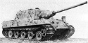
Skyworks posted:It is likely a military airbase of some sort. I remember reading something years ago that stated they store the fighter aircraft inside hollowed out mountains to prevent them being bombed and just roll them out and take off. Here is one of those. The China Air Museum at Datanshan is a formerly secret air-base drilled through the side of a mountain big enough to drive a 60's vintage intercontinental bomber through. http://maps.google.com/maps?f=q&sou...012338&t=h&z=17 You can see the distintive hexagonal arrangement of an SA-2 Missile battery, as well as two TU-4 Bull strategic bombers that were copied from the American B-29, the TU-16 that dropped China's first Hydrogen bomb, three American built C-46 transports captured from the KMT, and more Mig 15's than you can shake a stick at. Slo-Tek fucked around with this message at 22:24 on Dec 9, 2010 |
|
#
?
Dec 9, 2010 22:19
|
|

|
jagdtiger00 posted:Looks vaguely like 1963 to me Looks like 1983 to me. I go fishing there quite a bit, I have to try to find out when it was built. 63 might make more sense given the size of the trees. Cool find, never new about it till now.
|
|
#
?
Dec 9, 2010 22:58
|
|

|
It's quite clear that it's 196Z.  The last digit sure looks like a 7 (look at the color of the foliage) to me but the third looks similar enough to the second that it may be 1997
|
|
#
?
Dec 10, 2010 05:50
|
|

|
The SARS Volta posted:This thread is awesome so I'll help keep it alive: I actually used to take dancing classes just around that area, and we often did musical plays on a stage we built just in front of the trees. While we comfortably could fit about 2000 spectators, our record numbers came in 2003 when we did a rock version of the hit musical Annie (the one about the orphan kid) in front of a crowd of around 1400. I played the role of Daniel Francis "Rooster" Hannigan and got rave reviews in the local papers. As a result I will star in the upcoming remake of the movie, albeit only as a dancer. Look for me in the background of "You're Never Fully Dressed Without A Smile". I almost forgot to tell you why it says 1967. That's simply the year the head of the dancing school, Ms. Andrews, was born. Dec. 19, 1967. Actually, everything above this is a lie, except the year. I found the place on Bing, did some searching, and found what I think is the answer.
|
|
#
?
Dec 10, 2010 09:25
|
|

|
One for UK soap fans: Google Link Edit: It's the exterior set for 'Emmerdale'. Biggus Dickus fucked around with this message at 16:52 on Dec 10, 2010 |
|
#
?
Dec 10, 2010 10:33
|
|

|
The YOUNG ONES HOUSE http://wikimapia.org/14479941/25-Broadway-Road-The-Young-Ones-House http://maps.google.com/maps?ll=51.4...isc&ct=api_logo
|
|
#
?
Dec 10, 2010 10:42
|
|

|
Slo-Tek posted:Here is one of those. The China Air Museum at Datanshan is a formerly secret air-base drilled through the side of a mountain big enough to drive a 60's vintage intercontinental bomber through. This sort of thing was prevelant when the accuracy of delivery systems was measured in miles rather than hunderds of metres. Burrow important stuff into the side of a mountain and it prevents some of the nasty things like overpressure (blown away) and thermal damage (lit on fire). Pretty good idea too, you need to hit it hard, repeatedly and at ground level. It is doubly effective as a groundburst is less desirable than an airburst when you are looking for the best bang for your buck, and the first hit throws so much crap up it makes hitting it repeatedly much harder. Systems are more accurate now, so they don't use this defense. This makes places like this all the more cooler to find. Keep searching, once you know what to look for there is stuff like this everywhere left over from the bad old days. Skyworks fucked around with this message at 15:57 on Dec 10, 2010 |
|
#
?
Dec 10, 2010 10:54
|
|
|
torjus posted:Actually, everything above this is a lie, except the year. I found the place on Bing, did some searching, and found what I think is the answer. Holy poo poo. I did some geocaching back in the day but never made it down there. Good work sir.
|
|
#
?
Dec 10, 2010 15:47
|
|
|
http://maps.google.com/maps?q=61.26...1,0.026157&z=16 The Elephant Cage! Only, not. It's actually a signal intercept station.
|
|
#
?
Dec 10, 2010 16:22
|
|

|
the old Buffalo Central Terminal doesn't look as odd from the air as the ground, but it still conveys that sense of fallen empire and looks like a patch of eastern Europe in western NY. The shadow hints at how massive a structure it is, in what was once an urban center (and is now the sort of place you lock your car during daylight hours).
|
|
#
?
Dec 10, 2010 17:04
|
|

|
Skyworks posted:This makes places like this all the more cooler to find. Keep searching, once you know what to look for there is stuff like this everywhere left over from the bad old days. Actually something like this is located very close to me: An 1980ies era cold war bunker depot from the US army, intended to provide flown-in divisions with ammo and other gear in case the soviet army ever broke through the nearby Fulda gap. You can still see the hockey stick shaped main road with the small bunkers nearby. http://maps.google.de/maps?f=q&sour...021136&t=h&z=16 (And if you like stuff like that, here is a trip report I did when I went there a while ago. "MilEx" if you want to put it that way ") http://www.hoeni.de/pages/hobby_bunker_e.html - I still wonder if I should ever post a thread about visiting an abandoned fortress from the Maginot line, but its not really UrbEx and my pictures lack any artsy quality.) http://www.hoeni.de/pages/hobby_bunker_e.html - I still wonder if I should ever post a thread about visiting an abandoned fortress from the Maginot line, but its not really UrbEx and my pictures lack any artsy quality.)Also this here is interesting maybe: http://maps.google.de/maps?f=q&sour...010568&t=h&z=17 The combat blocks of a Maginot line fortress. Check out the Panoramio pics.
|
|
#
?
Dec 10, 2010 19:26
|
|
|
Hoeni posted:(And if you like stuff like that, here is a trip report I did when I went there a while ago. "MilEx" if you want to put it that way I'd be down to see this posted somewhere.
|
|
#
?
Dec 10, 2010 20:20
|
|
|
The Scientist posted:I'd be down to see this posted somewhere. Not only is this interesting it is educational. Despite not hitting the urbex standards, I would love for you to post this. Skyworks fucked around with this message at 19:44 on Dec 11, 2010 |
|
#
?
Dec 11, 2010 19:36
|
|
|
BENZO FURRY posted:the old Buffalo Central Terminal doesn't look as odd from the air as the ground, but it still conveys that sense of fallen empire and looks like a patch of eastern Europe in western NY. The shadow hints at how massive a structure it is, in what was once an urban center (and is now the sort of place you lock your car during daylight hours). Sounds like the Train Depot in Detroit
|
|
#
?
Dec 11, 2010 19:39
|
|
|
California City. Hundreds of planned, named roads, and nothing on them. Take a look around in street view. http://goo.gl/maps/Vokp 
|
|
#
?
Dec 11, 2010 20:24
|
|

|
It does have a go-cart track though.
|
|
#
?
Dec 11, 2010 20:35
|
|
|
shuriken posted:California City. That is an interesting one, but I suppose if the city proper expected a lot of rapid growth, it makes sense to expand the road infrastructure first.
|
|
#
?
Dec 11, 2010 20:35
|
|
|
Mister Roboto posted:That is an interesting one, but I suppose if the city proper expected a lot of rapid growth, it makes sense to expand the road infrastructure first. It's been like that for something like 50 years; I'm sure the tens of thousands of people dying to live in the desert will show up any day now.
|
|
#
?
Dec 11, 2010 20:56
|
|
|
Not really strange, but I thought it was fun. Elephants and Giraffes in Pittsburgh
|
|
#
?
Dec 11, 2010 21:38
|
|

|
comaerror posted:http://maps.google.com/maps?q=61.26...1,0.026157&z=16 http://goo.gl/maps/hitG
|
|
#
?
Dec 12, 2010 00:11
|
|

|
nurrwick posted:I'm liking the ancient airfield just to the south of there. On that note, this site is awesome: http://airfields-freeman.com/
|
|
#
?
Dec 12, 2010 00:21
|
|

|
withak posted:It's been like that for something like 50 years; I'm sure the tens of thousands of people dying to live in the desert will show up any day now. Perfect place to house pedophiles, since everyone is always crying we have no place to put them since California has laws against having them within a certain amount of feet from a school, and apparently there's very little places that qualify.
|
|
#
?
Dec 12, 2010 00:38
|
|

|
They probably don't want to live in the middle of the desert either.
|
|
#
?
Dec 12, 2010 00:48
|
|
|
withak posted:They probably don't want to live in the middle of the desert either. It is seriously an rear end-haul from anywhere. Essentially, in the 1960s, an urban planning professor decided that trends in growth suggested that the state was ripe for another big city. Naturally, he was the man to plan it and start development. His plan suffered only from having the only available land be three hours and a mountain range from either Los Angeles or Bakersfield, lacking in water, and devoid of any reason for people to live there or business to set up there aside from the fact that the land was cheap. Turns out that the land was cheap because it is worthless. Yet, it is also austerely beautiful and I am glad that it was not made into some sort of storage dump for either pedophiles or suburbanites.
|
|
#
?
Dec 12, 2010 02:29
|
|
|

|
| # ? Apr 27, 2024 17:36 |
|
|
withak posted:It does have a go-cart track though. A city that was planned on the premise of 'Build a go-cart track and they will come?'
|
|
#
?
Dec 12, 2010 02:38
|
|
