


|
I don't think we have our position quite right. We see a mountain to our north (with a river on it's west side, looks like), but if I'm reading the map right, our estimated position should see a saddle between mountains, with a lake in a depression beyond that. I'd guesstimate us further to the east, but needs to compare pics to map a little more. Beyond that, I agree with the plan. We can get looting/packing while we work on our position a bit more.
|
 #
¿
May 17, 2018 18:34
#
¿
May 17, 2018 18:34
|
|


|

|
| # ¿ Apr 24, 2024 17:57 |
|
|
lofi posted:Yeah, I think you're right, that would make more sense. If we're nearer the edge of the map, positioning is going to be tricky with so much we can't see - we'll need to basically ignore everything we can see to the east. Now that I'm distinguishing forests and rivers right, that seems like it could be it. A quick note, I don't know if any of us were accounting for the magnetic declination. I'm not sure which way it goes. Wikipedia seemed to suggest that a positive declination means our compass points us clockwise of our actual direction. But this position only makes sense if we assume that's it's the other way round. And I couldn't see other locations that made sense to me. I'm gonna assume it's right for now. When we start walking, we should be able to sort such things out pretty quickly. The good news is that the original travel plan is still pretty much valid. The bad news is that we may have an additional river crossing. When we start walking (after seeing what we have from the plane), we should initiall head along level ground to west-north-west (west on our compass). That should take us roughly to where we first estimated we were.
|
|
#
¿
May 17, 2018 19:18
|
|

|
Based on the existing discussion, I say we take two sets of clothes (and starting walking in the light ones), the ground cover, the sleeping bag, the raft, the stove (and fuel!), the matches, and a selection of food. Maybe other things, but we'll want those at the least.
|
|
#
¿
May 18, 2018 17:36
|
|
|
Take the rock. Eat some food before we go (after all, the best way to store And that heading looks about right. I agree about 1.5 hours should be good to double-check our position, orientation, and condition.
|
|
#
¿
May 19, 2018 00:23
|
|
|
Looks like we're wearing the right clothes for our walk right now. I agree with resting and then continuing in the same direction.
|
|
#
¿
May 22, 2018 03:15
|
|
|
I'm not sure how much, but we should definitely drink. And I like the idea of eating some bread. Then NNW (315 magnetic?) for 1.5 hours. Also, lofi, thanks for the map updates. You're matching my feel for our position.
|
|
#
¿
May 23, 2018 03:30
|
|
|
Kangra posted:I'd still argue for heading about 300 magnetic (I realized we need to be clear about stating the bearing system) since turning far northerly adds a fair amount of distance to our trip toward the river. On the other hand we may be moving pretty quickly, so it's hard to say. If we go a few hours at a time then later adjustments are okay. I think the idea is to try and get further upstream on the river we need to cross, before meeting the river that goes around Steep Mountain. I'm torn on this, as you point out it'll increase the distance we walk (and worse, it's uphill), but I'm really dreading that river crossing. Also, lofi described the rivers as in-the-way-river and the dogleg river. I say we make those our official names: In-The-Way-River and Dogleg River.
|
|
#
¿
May 23, 2018 18:02
|
|
|
Coolguye posted:there is the TASTE command. Well then, let's be tasting everything we see on this walk. Obviously if it's bitter we'll spit it back out, but everything else should be fair game.
|
|
#
¿
May 24, 2018 14:46
|
|
|
Hey, I never said tasting (and possibly eating) everything we find was a good idea, it just seems in character.
|
|
#
¿
May 25, 2018 00:27
|
|
|
Nice piece of fish posted:I suggest we set up camp for now, hang up some food and get a fire going. Agreed.
|
|
#
¿
May 25, 2018 15:05
|
|
|
lofi posted:Agreed. I hadn't bothered doing my own legwork on estimating position, but this matches my intuition. Kangra posted:I'm okay with setting up camp for resting purposes, but we don't have to worry about losing light. We've got two hours just to sundown. Oooh, good idea, let's do that just for the sake of confirmation.
|
|
#
¿
May 25, 2018 17:31
|
|

|
Make camp. It seems we're rather close to the river, and I want to deal with that well rested and with plenty of daylight. Seconding trying to make a fire without matches, and we'll make sure to eat up and drink some water. And hang our backpack (with the food all in it). Do we need to worry about defecation in this game? If so, we should try to figure that out, too.
|
|
#
¿
May 26, 2018 02:50
|
|
|
Can we tell how much snow ended up on the ground? If we're trudging through much, we might want to consider solutions. Also, is it a bad idea to just fill our water bottle up with snow?
|
|
#
¿
Jun 9, 2018 15:56
|
|
|
Yes, when we do go (which should be soon), make sure we pick up all our things, and let's go in the same direction. We'll hit the river before long, and will need to figure out how to cross it.
|
|
#
¿
Jun 9, 2018 18:17
|
|
|
Kangra posted:Going on the game's scale where everything is about 4-5 times larger than normal, I'm guessing a marked river isn't able to be crossed easily. Comparatively 50-100 feet wide here, I'd guess. I second this plan. Also rationing food and boiling snow (or water) when we set camp at night.
|
|
#
¿
Jun 11, 2018 05:02
|
|
|
Raft, but seconding the double-check of our clothes.
|
|
#
¿
Jun 12, 2018 02:45
|
|
|
I saw we walk a very short distance west (297 magnetic, unless I'm messing up the math again), which should match Fish's direction. We can see how that's affecting our pace, and then decide if we need to stop and rest. I say we keep the raft, we can use that for getting to the end.
|
|
#
¿
Jun 12, 2018 16:48
|
|
|
I agree to not go with 297, and aim for the saddle instead.
|
|
#
¿
Jun 13, 2018 02:56
|
|
|
That's definitely the right direction. We look set to intersect Dogleg River near the slope of Steep Mountain, where we can follow it.
|
|
#
¿
Jun 17, 2018 17:15
|
|
|
I'm in favor of the plan to rest and fish for a day, try to warm our hands on a fire, and see if we can't trap something furry enough to make mittens from. Also for dropping the repellent and snakebite kit.
|
|
#
¿
Jun 19, 2018 19:50
|
|
|
I forgot about the rice. How about we cook it for our dinner and breakfasts, leaving the other food as stuff we can eat while walking?
|
|
#
¿
Jun 20, 2018 17:04
|
|
|
A.
|
|
#
¿
Jun 20, 2018 23:38
|
|
|
Black Robe posted:We've also got the stove and its fuel while we're stopped, though I think consensus is pretty much in favour of leaving it behind when we go. Might as well use it up, keep the stove burning constantly. I second this plan. Also at least experimenting with the magnifying glass. We should see if we can get it to work, otherwise it's something else for the junk pile.
|
|
#
¿
Jun 22, 2018 04:13
|
|
|
I can't recall, what were our conclusions about the snakebite kit? And would the tennis shoes actually be useful?
|
|
#
¿
Aug 18, 2018 17:18
|
|
|
Coolguye posted:1) it's too drat cold for snakes and the game doesn't even spawn any venomous snakes in this place anyway That's what I thought. I agree we should drop them. Well, unless we can think of an entertaining purpose to them.
|
|
#
¿
Aug 18, 2018 22:25
|
|
|
Keep the rock, run a test to see if sleeping in the forest is necessary.
|
|
#
¿
Aug 24, 2018 20:11
|
|
|
Covski posted:This thread is still alive gosh darn it Even more surprisingly, Goonpa is still alive. Though if we leave the rock, not for long.
|
|
#
¿
Sep 13, 2018 05:36
|
|

|
I like lofi's plan.
|
|
#
¿
Nov 7, 2018 05:48
|
|
|
I'm with plan B.
|
|
#
¿
Nov 8, 2018 06:48
|
|
|
Keep the raft, grab the trap, leave the stove.
|
|
#
¿
Feb 26, 2019 03:39
|
|
|
C, C
|
|
#
¿
Mar 4, 2019 17:44
|
|
|
lofi posted:
Your map continues to match my notions of where we are. Good work!
|
|
#
¿
Jun 18, 2019 20:42
|
|

|
We should raft now. I'm worried though, because it looks like there might be another river in the way afterwards.
|
|
#
¿
Jul 2, 2019 07:40
|
|
|
lofi posted:Yup, we called it endboss river for a reason. I meant the one starting in the south-west marsh and flowing south. It looks like it could extend north enough to be a problem.
|
|
#
¿
Jul 2, 2019 17:24
|
|
|
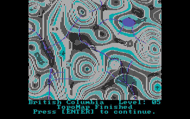
Kangra posted:Are you talking about the blue line in the marsh/woodland near where we are, a little to the west? That's a contour line rendering there, as there's no river drawn on the original terrain map (without contours). Ah, I was seeing the strangely shaded contour line. That's a relief. Though given our overall status, relief is the last thing I should feel.
|
|
#
¿
Jul 2, 2019 19:35
|
|
|
Black Robe posted:I'm pretty sure that's just a contour line that's purple because it's overlaid by forest. And it's named Bullshit Creek, even though it doesn't exist. Because it already caused some confusion. Anyways, I tentatively agree with the plan unless there are other ideas or are objections. It's a little bit uphill, but there's always the chance for fish.
|
|
#
¿
Jul 10, 2019 16:02
|
|
|
Concur, magnetic west.
|
|
#
¿
Aug 15, 2019 02:31
|
|
|
I'd be interested to try the challenge. It's liable to go hilariously wrong, but that's the fun of it!
|
|
#
¿
Dec 22, 2019 08:11
|
|
|
He made it so much further than i would have expected (you know, more than two steps). Rest well, Goonpa.
|
|
#
¿
Dec 27, 2020 19:00
|
|
|

|
| # ¿ Apr 24, 2024 17:57 |
|
|
I got as far as downloading it, even launching it I think. But I have so many other things to do in my free time, like reading LPs.
|
|
#
¿
Feb 18, 2021 06:13
|
|